Treaties Explorer
The Indigenous Digital Archive Treaties Explorer was created by the Museum of Indian Arts and Culture Sante Fe New Mexico and in partnership with the U.S. National Archives Office of Innovation and National Archives Foundation. All the technical work and software development was delivered by Digirati in Glasgow and London.
Thanks to a generous and anonymous donor the U.S. National Archives have conserved and digitised the 374 ratified Indian treaties in their holdings. The ambition of the Treaties Explorer project was to take these digitised documents and make them available online as IIIF. Furthermore the project brings them together with other sources of data such as the GIS data maintained by the U.S. Forestry Service, images of historic maps maintained by the Library of Congress, tribe names from the National Parks Service and digitised versions of other printed documents held by Hathi Trust and by the Internet Archive.
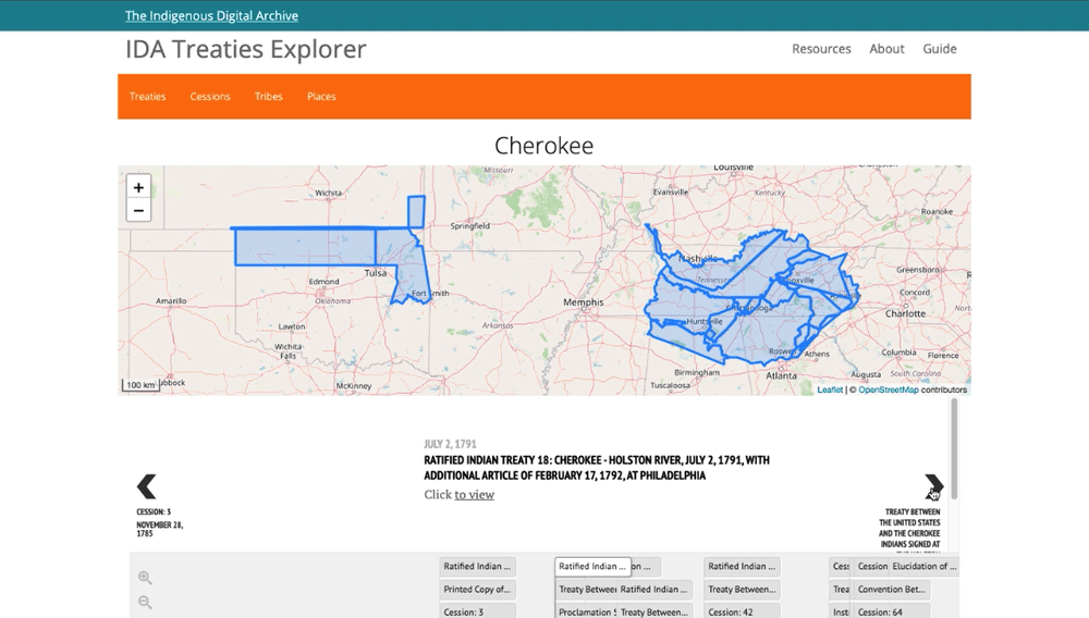
There are two broad classes of document on the Treaties Explorer site, the first is the 374 ratified Indian Treaties themselves. The second are records of land boundaries known as “cessions”, which originate in the late 19th century as an attempt by government clerks to research land transfer treaties and other agreements between the native nations and the U.S. State and plot these on maps.
The site organises the information by document type (treaty or cession), the present day and historic tribe associated with those documents, and also by the places that they are associated with. The result is a rich discovery interface of interactive maps, digitised treaties viewable with deep zoom images, facets and linked data which together enable users to connect the dots between treatises, cessions, places and both historic and present day tribes.
There is plenty of further information on the DigiTreaties.org site and the video above provides a quick overview and demo.